ซอฟต์แวร์เพื่อการพักผ่อนหย่อนใจที่เหมาะกับการนำทางทางทะเลทุกประเภท
คุณสมบัติ
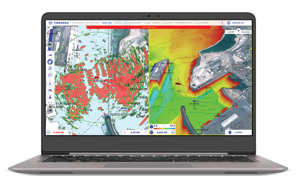
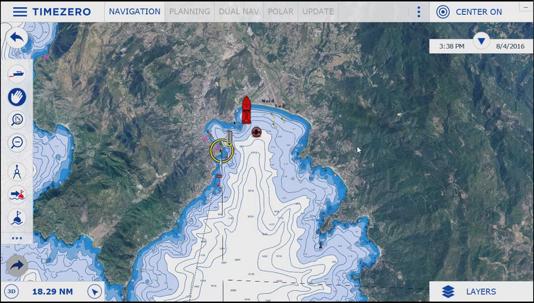
เข้าถึงโลกทั้งใบได้ในปลายนิ้วของคุณด้วยแคตตาล็อกแผนภูมิ mm3d ที่เข้ากันได้กับ TZ Navigator ซึ่งสามารถครอบคลุมทั่วโลกด้วยแผนภูมิแรสเตอร์และแผนภูมิเวกเตอร์ (C-MAP และ Datacore โดย Navionics) นอกจากนี้ เทคโนโลยี TIMEZERO ยังผสานรวมเครื่องมือสร้างแผนภูมิที่ไม่มีใครเทียบได้ โดยผสมผสานแผนภูมิทางทะเล ข้อมูล 3 มิติ และภาพถ่ายดาวเทียมอย่างชาญฉลาดผ่าน PhotoFusion
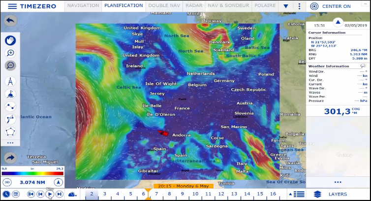
เพลิดเพลินไปกับพยากรณ์อากาศและฐานข้อมูลกระแสน้ำฟรีของเราไม่ว่าคุณจะเดินทางไปที่ใดทั่วโลก
ตัวช่วยวางแผนเส้นทางช่วยให้คุณคำนวณเวลาออกเดินทางตามเงื่อนไขต่างๆ (กระแสน้ำ กระแสน้ำ เวลาเดินทาง ฯลฯ) การมาถึงในช่วงน้ำขึ้นหรือออกจากท่าเรือในสภาพกระแสน้ำที่เหมาะสมไม่เคยง่ายขนาดนี้มาก่อน!
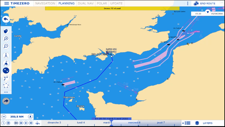
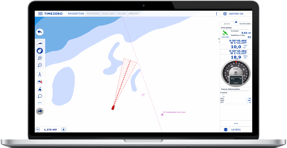
กรวยความปลอดภัยแบบใหม่เป็นคุณลักษณะที่ปฏิบัติตามกฎอย่างเป็นทางการของ IMO โดยคำนึงถึงข้อมูลของแผนที่เวกเตอร์เพื่อตรวจจับอันตรายที่แยกตัวออกไปและพื้นที่น้ำตื้น หากตรวจพบสิ่งกีดขวางภายในกรวยนี้ด้านหน้าวิถีของเรือ ระบบจะส่งสัญญาณเตือนการเกยตื้นโดยอัตโนมัติ
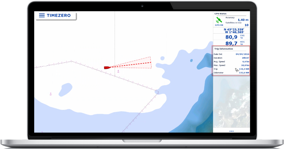
นอกจากนี้ Odometer NavData ใหม่ของเราจะแสดงข้อมูลการเดินทางของคุณโดยอัตโนมัติ รวมถึงระยะเวลา ระยะทาง ความเร็วสูงสุด และความเร็วเฉลี่ย
อินเทอร์เฟซผู้ใช้ของ TZ Navigator เป็นแบบใช้งานง่ายและปรับให้เหมาะกับการใช้งานบนหน้าจอสัมผัสได้อย่างสมบูรณ์แบบ หน้าจอสัมผัสทำให้ชีวิตของคุณง่ายขึ้นมากเมื่อต้องวางแผนเส้นทาง รวมถึงฟีเจอร์อื่นๆ ทั้งหมดที่ทำให้ TIMEZERO ประสบความสำเร็จอย่างมากมาเป็นเวลากว่า 30 ปี
สำรวจฟีเจอร์หลักๆ:
- เป้าหมาย AIS / ARPA
- สภาพอากาศ
- แผนภูมิเครื่องยนต์
- การซิงโครไนซ์คลาวด์
TIMEZERO นำเสนอโมดูลเสริมมากมายที่จะช่วยปรับปรุงประสบการณ์การนำทางของคุณให้ดียิ่งขึ้นผ่านการกำหนดเส้นทาง การแสดงวัตถุโดยรอบ และการรับข้อมูลพื้นทะเลที่มีค่า
- การกำหนดเส้นทาง
- เรดาร์
- เครื่องส่งเสียง
- สภาพอากาศพรีเมี่ยม
เอกสารประกอบ